The following account of the Wednesday October 25, 2017 ‘geology’ event Reading the Rocks.
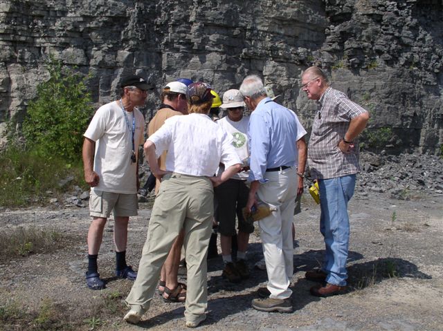
Wednesday was a beautiful cool, crisp October morning as the Mississippi Valley Field Naturalists and friends gathered in Metcalfe Geoheritage Park for “Reading the Rocks,” led by Neil Carleton, a founding MVFN member. It was the perfect backdrop for the drama that was about to unfold. Four dozen heads tilted backward as Neil began our breakneck journey through geological time, by sweeping his arms skyward, pulling the Grenville Mountains from their ancient roots, to dizzying heights. Beneath these towering behemoths, we imagined the tremendous heat and pressure that would transform the rock, limestone to marble and shale to schist, 20 km beneath our feet.
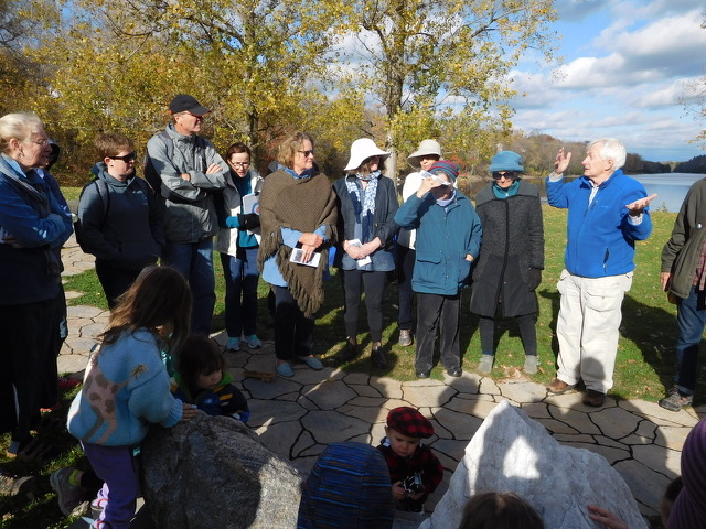
Meanwhile, as the continents restlessly wandered the globe, Neil’s arms fell as the equatorial landmass that would become North America was covered in a succession of tropical oceans. His voice filled with awe as he described the diversity of marine life in the warm, shallow seas. Pointing downriver to a distant landmark, he was ready to take us further on our exploration in time, but closer to the present when a cooling climate triggered a global ice age. Tipping the landscape on its head, the outcrop now stood 2 km atop a glacier. We could almost hear the grinding of the massive continental ice sheet in its relentless advance, scouring the landscape and smoothing the bedrock to a polished finish. Neil’s hands and arms floated away from his body as the ice melted leaving behind the rock debris known as glacial till.
Neil then turned to the scientific record of the events he had described so eloquently. It is all there in the folded layers, bedrock striations, and colourful minerals if you take the time to read the rocks. He pointed to a large slab of micaceous schist that formed deep in the roots of the Grenville Mountains. He traced the fossils of predatory cephalopods, the uniquely preserved burrows of soft-bodied organisms, and the rippled sediments frozen in the rock of what was once the near shore bottom of an Ordovician Sea. Ruler straight lines on the face of one boulder and a conglomerate rock formed by the cementation of igneous, sedimentary and metamorphic rocks formed in very different ways, in very different places, that had been carried in and under the ice sheet, and left behind were evidence of the melting ice as it receded from the area only some 11,500 years ago.
The group then moved to tables of fossil specimens that Neil had set up for closer examination. A microscope allowed a look at the fine details of the corals, brachiopods, and trilobites that inhabited the prehistoric seas of our area. A scavenger hunt of geological words further engaged us in our exploration of rock and fossils. Neil wrapped up the morning by answering questions and distributing “loot bags” containing local rock samples with labels, along with shells from the Champlain Sea.
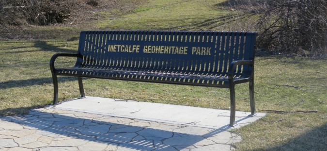
Metcalfe Geoheritage Park is located at the base of Bay Hill (i.e. at the rivers edge at 250 Almonte Street in Almonte. For directions see http://mvfn.ca/events/reading-the-rocks/). Try your hand at reading the rocks. There are pamphlets at the park to help you, or bring along your smartphone and access in-depth information, through the QR codes located at the base of each sample. Learn what the rocks have to tell us about the fascinating geological history of Almonte and the surrounding area.
By Gretta Bradley